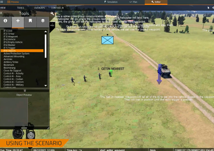
![]() | VBS4 |
Whole-Earth Virtual Desktop Training & Simulation Host |
VBS4 provides a comprehensive virtual desktop training environment with whole-earth rendering for tactical training, experimentation, and mission rehearsal, and performs as a powerful simulation host for any IG |
What is VBS4
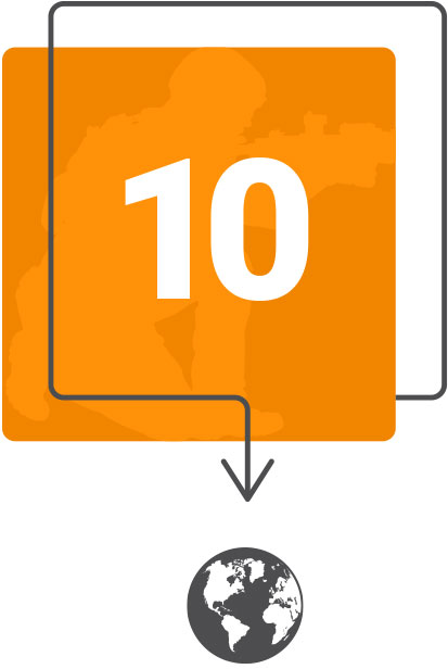
VBS4 is a whole-earth virtual desktop trainer and simulation host that allows you to create and run any imaginable military training scenario. 
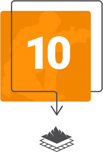
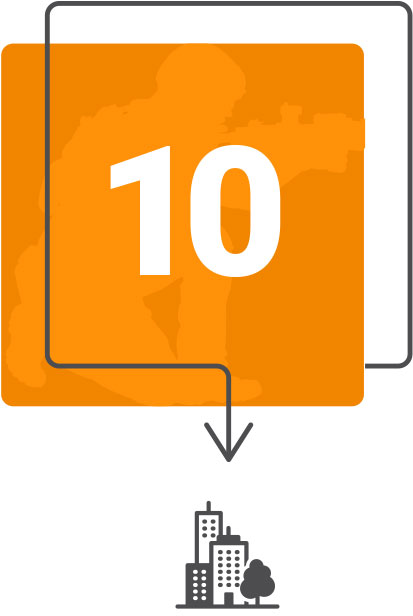
The VBS4 workflow steps the user through Prepare - Execute - Assess phases, facilitating fast and effective skills enhancement. In VBS4, users create “Battlespaces” that are a collection of terrain edits, mission plans, scenario files and after-action reviews.
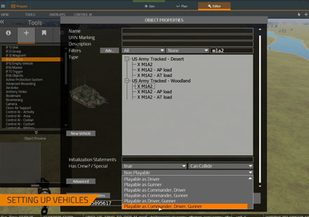
 Each Battlespace is centered on a specific location on the virtual Earth. Scenarios can be modified in real time and replayed in the After-Action Review for lessons learned. VBS4 scenarios can be fully constructive (AI controlled), fully virtual (human controlled) or a mix of both. |
Edit terrains and collaborate with other users to build terrains with an easy-to-use interface
Facilitate commander training with VBS4’s easy-to-use mission planning tool
Create complex scenarios with VBS4’s powerful 3D editor
Enable commanders to plan missions and issue orders to AI
Allow administrators to change any aspect of the scenario
Give trainees control of an avatar from first-person perspective
Provide full-featured radio simulation for communication practice
Replay scenarios in 2D and 3D from any perspective, anywhere on the virtual Earth
Review performance measures that are saved automatically during AAR capture
Through open APIs, leverage AAR data for use in third-party training management tools
VBS4 includes whole-Earth data and supports training at any location on the virtual globe. The underlying technology — VBS Blue — is a high-performance, whole-planet data ingestion, procedural enhancement and rendering engine, which renders realistic scenes at any altitude (from space down to ground level) with real-world view distances. The VBS World Server (VWS) is included with VBS4, and provides whole-Earth building and road data from OpenStreetMap (OSM), accurate heights and forest coverage, and correct biomes for every region on Earth used to procedurally enhance the base data.
Whole-Earth capability dramatically reduces terrain development time and the terrain server capability (free with VBS4) saves administration overhead by centralizing terrain data. This is a step-change compared to VBS3!
VBS4 includes VBS Plan, a new mission planning capability that creates massive time savings for instructors and administrators by allowing them to draw static plans on the 2D and 3D maps using standard military symbols, and then execute those plans at an entity level in VBS4. With VBS Plan, users created a synchronized Company-level plan 100 times faster in VBS4 than in VBS3.
VBS4 includes VBS Geo, a new intuitive WYSIWYG editor that allows users to import, create and modify terrain. The interface enables users without formal training to quickly and easily edit terrains.
Users can add, move and rotate objects on the terrain, raise or lower terrain, edit roads and other linear features, quickly draw new forests and edit surface detail, and immediately leverage these terrain changes in VBS4 scenarios. Testing has shown that editing terrain using VBS Geo is 10 times faster than using Visitor4 in VBS3.
A powerful companion application (free with every license of VBS4), VBS World Server (VWS) is a geospatial data server that provides efficient networked access to high-fidelity terrain for the entire planet. While other rendering engines ingest and render 3D data, they do so exclusively for visual display. The VBS World Server is different in that it automates processes to import, curate, mesh and classify data for interactions like walking/driving on terrain, collisions, entering buildings and simulating destruction for real-time simulation.
VBS4 or VBS Blue IG can stream high fidelity terrain data from VWS in a performant manner. Both new and legacy terrain formats are supported through new VWS plug-ins. VWS is optional, and both VBS4 and VBS Blue IG support local terrain data storage in addition to VWS.
BISim aims to reduce human intervention in simulation exercises through its VBS Control deterministic and doctrinal AI that is fully integrated with VBS4 and the new mission planning component.
VBS4 includes the following pre-built AI behaviors:
Convoy AI: reliable ETA, react to ambush, navigate tight urban spaces
Military AI: a set of “waypoint replacements” for improved military AI, both infantry and vehicles
Pattern of Life: civilian and traffic “clutter”
A powerful simulation host for VBS Blue IGVBS4 can drive multiple IG channels with multiple viewports as a high-fidelity simulation host. Connecting VBS4 to BISim’s VBS Blue IG is trivial and a range of display types are supported, from multi-channel domes to VR head-mounted displays. Terrain edits made in the VBS4 terrain editing tool can be saved on the VBS World Server and are instantly available in VBS Blue IG or any other connected IG. |
Does Everything VBS3 Does and More!VBS4 will include all VBS3 capability and support all VBS3 use cases.
The VBS scripting language is available in VBS4. |
The VBS Simulation SDK includes a library of APIs and source code allowing developers to customize virtually every aspect of VBS4 and produce custom applications. The APIs form a modular, C plug-in architecture that enable developers to integrate third-party technologies effectively and efficiently.
BISim offers a support package that entitles license holders to upgrades, essential support services and access to BISim’s customer portal. We also offer professional services hours to help customers develop cost-effective solutions to meet their unique requirements.