ORLANDO, USA — Bohemia Interactive Simulations (BISim), a leading global developer of military simulation and training software and LuxCarta, a company specialized in the production of geospatial products derived from satellite imagery, announced today that BISim will be promoting and distributing LuxCarta’s geospatial products. These geospecific layers are a critical input to the terrain databases used to provide realism to militaries for their simulations for training within BISim’s VBS4 and other runtimes supported through its Mantle ETM platform, including Cesium, Unreal Engine and Unity.
“This announcement formalizes a relationship we have been building with LuxCarta for the past few years,” said Pete Morrison, Chief Commercial Officer, BISim. “We’ve already delivered some very realistic representations of areas of the world that are not covered by traditional datasets (e.g., OpenStreetMap). Their geospatial expertise is a perfect complement to our terrain services business with the end customer ultimately benefiting from more accurate terrains and immersive simulations.”
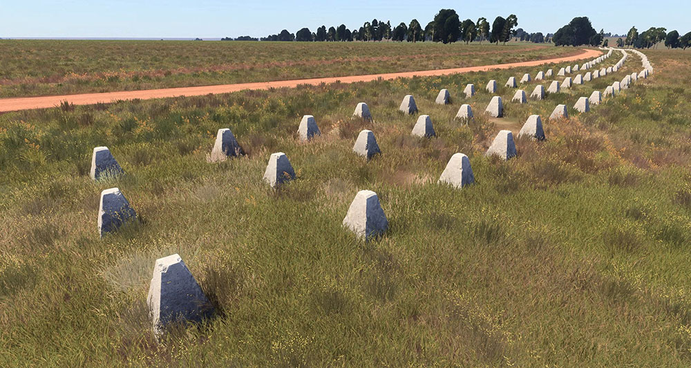
Under terms of the partnership, BISim will promote and deliver LuxCarta geospatial products, including BrightEarth™ global basemaps, land use / land cover (LULC) and digital terrain models, as well as geospecific 3D buildings, vegetation, walls, and roads extracted from sub-meter imagery to its customers. Specialized products including trenches, defensive obstacles, and detailed LULC along with a catalog of existing products will be made available to end customers by BISim’s account teams.
LuxCarta is a leader in applying machine learning algorithms to the extraction of objects from satellite imagery. The company’s AI algorithms have been tested across a series of different sensor types in countries around the world. They are used daily by its production team to deliver derived geospatial products to customers in a series of vertical markets.

“We’re excited to be partnering with the industry leader in collective training simulation software and delivering detailed geospecific inputs for VBS customers around the world,” added Albéric Maumy, CEO of LuxCarta. “We’re eager to show customers and prospects what’s possible when building terrains for VBS4 using LuxCarta’s derived geospatial products at this year’s I/ITSEC.”
LuxCarta’s geospatial products will be displayed on the BISim stand 1071 through compiled terrains within VBS4. Unique crop types generated by specialized LULC, as well as intricate anti-tank defences and geospecific trenches supplied by LuxCarta will be rendered with unparalleled accuracy within VBS4.
LuxCarta is demonstrating its BrightEarth suite of products for terrain development, along with some of its new material information features for Infrared (IR) simulation and its new road and wall extraction capabilities as shown in VBS4. LuxCarta is exhibiting at stand 2848.
About BISim
Founded in 2001, Bohemia Interactive Simulations (BISim), a wholly owned subsidiary of BAE Systems, Inc, is a global software company at the forefront of simulation and training solutions for defense and civilian organizations. Our in-house engineers use the latest game- based technology to develop high-fidelity, cost-effective training and simulation software products and components for defense applications.
About BrightEarth
BrightEarth is LuxCarta’s product line created using AI-enhanced production techniques. BrightEarth offers high-resolution building, tree and road extraction, 18-class land use/land cover (LULC) and digital terrain model (DTM) creation using a variety of imagery sources in real time. It also includes global basemaps including an imagery mosaic, LULC and DTM updated at regular intervals. These innovative products — based on more than 30 years of geospatial and remote sensing expertise — are ready for immediate download in a variety of formats or accessible via APIs in support of system-level integrations. There is no place in the world that LuxCarta can’t illuminate with BrightEarth.
About LuxCarta
LuxCarta focuses on the creation and delivery of geospatial products for the global telecom, simulation & training and other vertical markets. We specialize in the rapid production and delivery of quality fit-for-purpose mapping products to expert end users utilizing the latest AI technology advancements achieved through extensive R&D. Our customers are supported by skilled geospatial experts in their time zone through five corporate offices around the world. www.luxcarta.com
All trademarks are property of their respective owners.
For more information:
BISim
sales@bisimulations.com
LuxCarta
marketing@luxcarta.com
